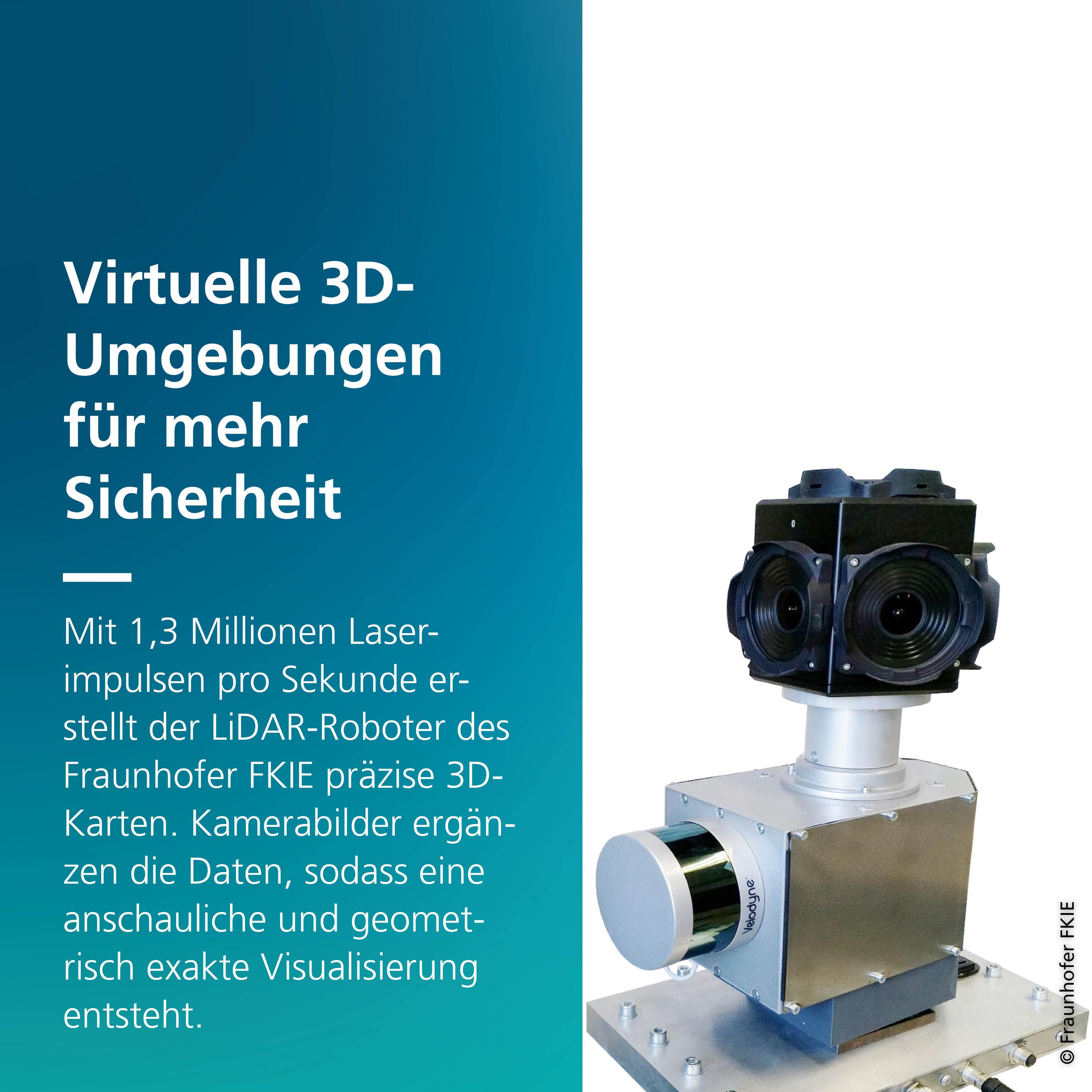
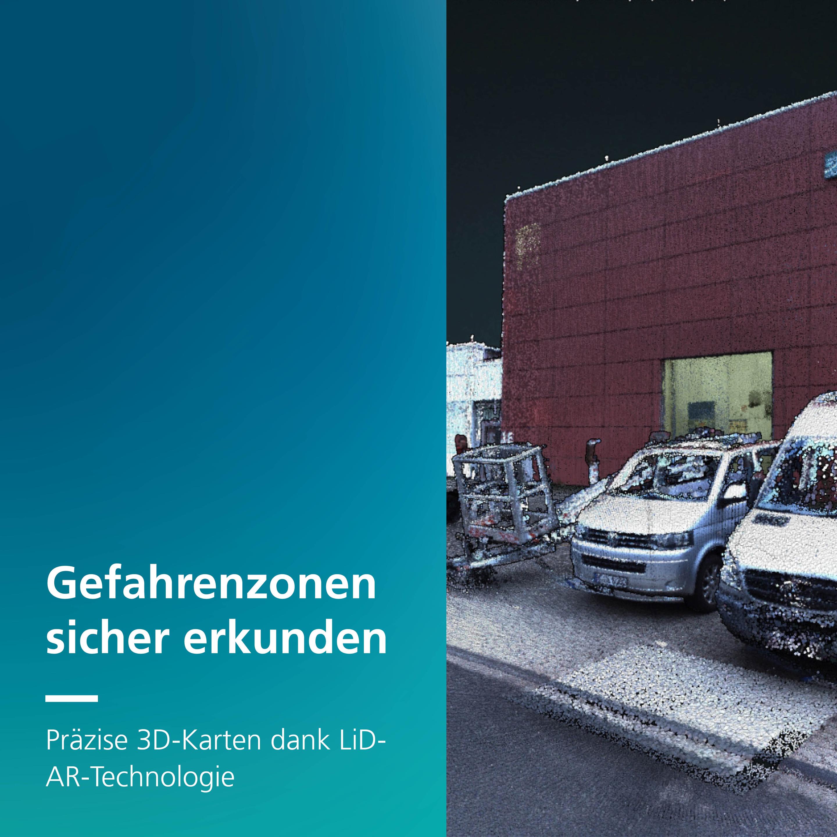
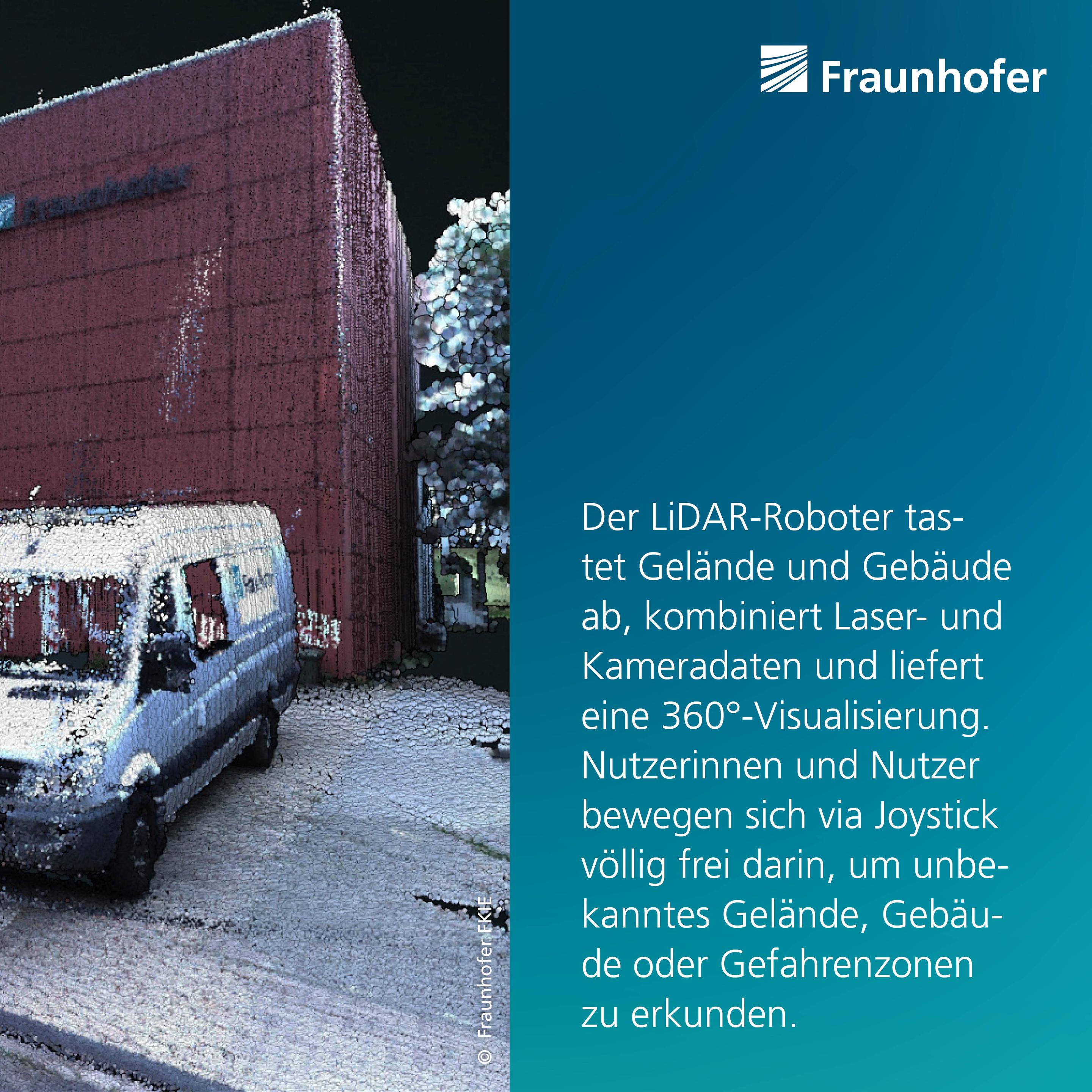
mathstodon.xyz is one of the many independent Mastodon servers you can use to participate in the fediverse.
A Mastodon instance for maths people. We have LaTeX rendering in the web interface!

Server stats:

2.8K
active users

#3Dmapping

0 posts0 participants0 posts today

GIS Corps Is Looking To Help Phreatic With Remote Spatial Volunteers
--
phreatic.org/ <-- shared home page
--
giscorps.org/become-a-voluntee <-- shared link to volunteer with GIS Corps
--
[want to be a part of some super interesting (remote) GIS volunteer work?!]
#GIS #spatial #mapping #volunteer #phreatic #explore #protect #seacaves #Sardinia #cave #caving #Phreatic #GISCorps #Italy #Supramonte #GulfofOrosei #model #3dmapping #environmental #speleology #hypogene #groundwater #waterresources #marine #marinecaves #coast #coastal
@GISCorps @Phreatic

Mapping the ‘dark universe’ bbc.com/news/science-environme

#Euclidtelescope had a problem locking on to a "guide star" during early testing. Until engineers could upload new software to its fine guidance sensor, the observatory was swivelling all over the sky.

#Euclid has 6 years to 3D map of one-third of the sky. The telescope combines breadth, depth and sharpness of vision.

A New, Underground Atlas Of Subduction Zones
--
eos.org/articles/a-new-undergr <-- shared technical article
--
submap.gm.umontpellier.fr/ <-- Submap, a tool for mapping subduction zones
--
“Graphic design meets geoscience…
Submap [link above] is a user-friendly tool that allows anyone with an Internet connection to create quick, custom maps of subduction zones…"
#GIS #spatial #mapping #visual #visualisation #visualization #subduction #geology #structuralgeology #Submap #geoscience #global #earth #platetectonics #subductionzones #earthquake #model #modeling #3dmapping #3dmodeling #opensource #opendata #tsunami #monitoring #fault #faulting #VisualizationTools #maps #crosssections

Blow-Me-Down Brook, NH – An NHD Flowline Picked ‘Randomly’
--
npshistory.com/brochures/saga/ <-- 1981 NPS guide
--
usgs.gov/3d-hydrography-progra <-- USGS’s 3DHP home page
--
I am working on some hydroaddressing / network traversing technical approaches for 3DHP – and needed an example of a multisegment flowline in NHD-sourced dataset, and so ‘randomly’ got this one - Blow-Me-Down, NH, from WBD HUC4-0108.
Although we map so many flowlines (~20 million in the USA for NHD-sourced spatial data, estimated 10x that for the EDH data still to be determined across the USA), I like trying to understand what a flowline or waterbody ‘is’ to the people on the ground as much as I can...
#GIS #spatial #mapping #networktraversing #3DHP #NHD #WBD #water #hydrology #USGS #mapping #USA #elevationderivedhydrography #EDH #3denabled #3dmapping #3dmodeling #3dep #elevation #opendata #nationally #waterresources #appliedscience #newhampshire #watermanagement #watermanagement #alldataisspatial #publicdata

Google Maps Updates Immersive View And Launches New Tools For Developers
--
blog.google/products/maps/goog <-- shared Google blog post
--
“From understanding a neighborhood at a glance to experiencing a place virtually like you’re really there, [Google] Maps has reimagined the way people navigate and explore. With advancements in AI, [Google is] introducing a whole new way to understand your route before you head out. Plus, developers can now tap into the magic of Maps’ immersive experiences…
#GIS #spatial #mapping #Google #GoogleMaps #routing #ai #technology #computervision #digital #people #parking #immersiveview #virtual #computervision #remotesensing #immersiveexperience #immersive #immersivetechnology #maps #routes #planning #upgrades #streetview #imagery #visualisation #aerialimagery #elevation #model #modeling #3dmapping #3dmodeling #3dmodel #localdata #dynamicdata #simulation #prediction #realtimemonitoring #realtimemapping #developers #development #applications #realtimedata