
Raspberry Pi LiDAR: Build Your Own 360° #LiDAR For Under $300
Recent searches
Search options

#lidar
8 posts8 participants1 post today

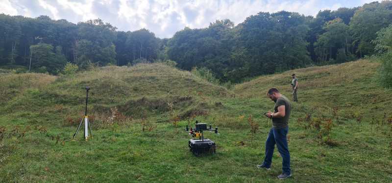
Trotz #LIDAR & Metallfunden war bisher unklar, wo die Belagerungsstellungen der Prosnitzer Schanze (1630/1677) lagen. Den Durchbruch bringen ein Kartenfund im #Riksarkivet & Geländedaten des LAKD-MV.
Tommy Jark in Fortifica: https://fortifica.hypotheses.org/4352
, Public Domain.")


Ein autonomer #Roboter der Osaka Metropolitan University navigiert mit #Lidar präzise durch #Hochbeete und kann sogar empfindliche Früchte wie #Erdbeeren ernten.
Grundlage ist eine Kombination aus virtueller Simulation und realer Testumgebung. Das System spart Zeit und Kosten und eröffnet neue Möglichkeiten für automatisierte #Landwirtschaft.
Voraussetzung sind aber kontrollierte Umgebungen, Fahrbahnen und etwa Hochbeete. 
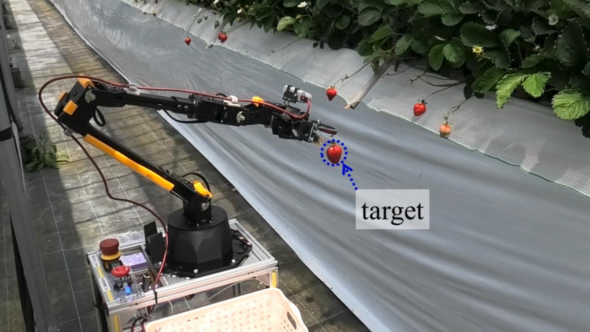
Golem.de · Erdbeerernte: Autonomer Roboter navigiert mit Lidar im Hochbeet - Golem.de

NOLA.com: Tulane keeps finding lost Maya cities, thanks to technology that's changing archeology
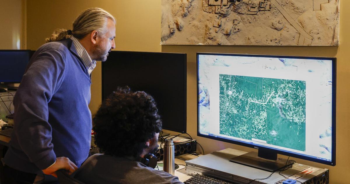
NOLA.comTulane keeps finding lost Maya cities, thanks to technology that's changing archeologyDiscovering Maya cities used to involve bushwhacking through the jungle, schlepping gear and sidestepping snakes. And over the course of his career, Professor Marcello Canuto has done plenty of that.

A decade ago I presented this pair of slides to an all-staff seminar at the Australian Antarctic Division. First shows a lidar pass as a reasonable scale for piloted aircraft. Second is a dense point cloud of a ship in sea ice showing a reasonable scale for RPAS/drone operations.
This is still true. At the time no small RPA existed that could operate in those conditions. In 2021/22 I was flying one in the Arctic, and it turns out slide 2 was very optimistic!

 of a ship in sea ice.
Title reads:
The space for RPAS (drones) for now.")

Someone made a LiDAR scanner with a Raspberry Pi, and it looks awesome
“If you’ve never heard of LiDAR before, it stands for “Light Detection and Ranging.” It can map out an area by firing lasers at it and recording how long it takes for the reflected light to return. It’s a handy way of creating a 3D model of a physic ...continues
See https://gadgeteer.co.za/someone-made-a-lidar-scanner-with-a-raspberry-pi-and-it-looks-awesome/

GadgeteerZA · Someone made a LiDAR scanner with a Raspberry Pi, and it looks awesome“If you've never heard of LiDAR before, it stands for “Light Detection and Ranging.” It can map out an area by firing lasers at it and recording how long it

A Pi-Based LiDAR Scanner - Although there are plenty of methods for effectively imaging a 3D space, LiDAR is ... - https://hackaday.com/2025/04/18/a-pi-based-lidar-scanner/ #2dvisualization #raspberrypi #vertexcolor #laserhacks #3dscanning #ldrobot #camera #lidar
Hackaday · A Pi-Based LiDAR ScannerAlthough there are plenty of methods for effectively imaging a 3D space, LiDAR is widely regarded as one of the most effective methods. These systems use a rapid succession of laser pulses over a w…

 Greg Cocks
 RiverREM - Generating River Relative Elevation Model (REM) Visualisations
--
https://github.com/OpenTopography/RiverREM <-- shared GitHub repository
--
https://opentopography.github.io/RiverREM/ <-- shared documentation
--
https://opentopography.org/blog/new-package-automates-river-relative-elevation-model-rem-generation <-- shared Open Topography blog post about RiverREM
--
H/T Heidi Luchsinger / Open Topography
[this post should not be considered as an endorsement of this product aka caveat emptor]
#GIS #spatial #mapping #remotesensing #earthobservation #Python #LiDAR #RiverREM #visualisation #hydrology #water #river #rivervalley #floodplain #terraces #GitHub #opensource #opendata #DEM #REM #model #modeling #RiverRelativeModel #documentation #tutorial #learning #tool #elevation #raster #sinuosity #drainage


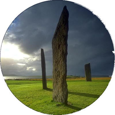
stone circles : cost-effective photogrammetry techniques for surveying, recording, documenting [pdf 25pp] #StoneCircle #photogrammetry #KiriEngine #lidar https://arrow.tudublin.ie/cgi/viewcontent.cgi?article=1230&context=level3


AI aids large-scale mapping of Angkorian reservoirs beyond Greater Angkor
A group of international researchers has harnessed the strength of artificial intelligence to reveal previously unknown reservoirs from the Angkorian period in Cambodia...
More information: https://archaeologymag.com/2025/04/ai-aids-mapping-of-angkorian-reservoirs/
Follow @archaeology


Schade #heise. Wieder mal ein Downer für mich: Ein für mich prinzipiell sehr interessanter Artikel zu Rasenrobotern, der mit keinem Wort erwähnt, ob man eines der Geräte auch ohne Verbindung zum Hersteller voll nutzen kann.
Starke Abhängigkeit zu einer App lässt mich vermuten, dass damit auch die #Cloud mitgemeint ist.
Dann hoffe ich, dass mein alter #Gardena möglichst lange noch durchhält. Der braucht weder Internet noch Cloud noch App für seine Funktion.
"Top 10: Der beste #Mähroboter ohne #Begrenzungskabel mit #Kamera, #GPS oder #Lidar"
https://www.heise.de/bestenlisten/testsieger/top-10-der-beste-maehroboter-ohne-begrenzungskabel-mit-kamera-gps-oder-lidar/gb7xhbg
Nebenbei: der flexible Begrenzungsdraht scheint mir immer noch deutlich praktischer zu sein als die teuren High-Tech-Alternativen: einfach zu installieren, einfach zu korrigieren/finetunen, lästig aber akzeptabel bei der Fehlersuche bei Kabelbruch.
YMMV.
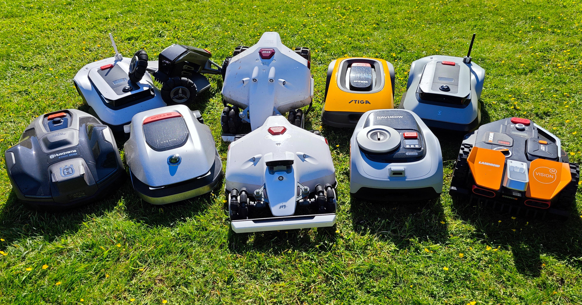
Heise online bestenlistenTop 10: Der beste Mähroboter ohne Begrenzungskabel mit Kamera, GPS oder Lidar | Heise online bestenlistenKabellose Mähroboter erleichtern den Umgang enorm, da kein aufwendiges Verlegen von Draht im Garten nötig ist. Wir haben den Großteil der erhältlichen Modelle getestet und zeigen, welcher der Beste ist. | Heise online bestenlisten

#LiDAR (1 m resolution) of the Atchafalaya Basin within the Centerville NW, LA, NE DOQQ showing Grand Lake & Big Bayou Pigeon in Iberia & St. Martin Parishes. There are 7 recorded archaeological sites in this view. #Archaeology

#LiDAR of the southwest 1/4 of the Boneset Creek, LA, quadrangle map I processed at 0.25 m resolution: Top) elevation range in blue-green-brown-red; Middle) expanded color palette; Bottom) overhead 3D rendering. #Maps #Archaeology


#Swisstopo hat seit 2017 das gesamte Land mit #Lidar kartiert. Diese Erfassung ist nun abgeschlossen, und über die Swisstopo-Website können die Datensätze kostenfrei heruntergeladen werden.
Was besonders auch die #Archäologie freut.
SWI swissinfo.ch: Feine Gelände-Scans machen die #Schweiz zur Fundgrube der Archäologie
www.swissinfo.ch · Feine Gelände-Scans machen die Schweiz zur Fundgrube der Archäologie

Factors and effects of interindividual variability in silver birch phenology using LiDAR time series and field work #lidar
https://www.sciencedirect.com/science/article/pii/S0168192324003666
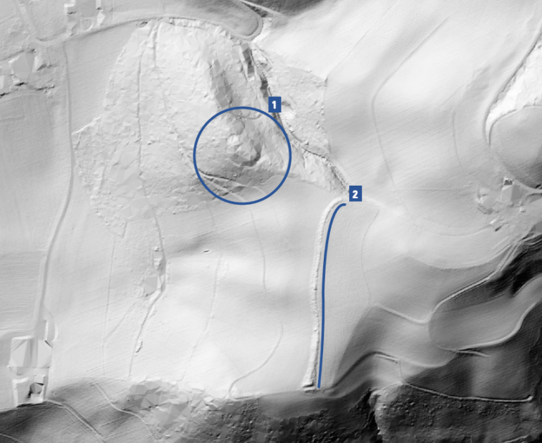
Kinematic Evolution Of A Large Paraglacial Landslide In The Barry Arm Fjord Of Alaska
--
https://doi.org/10.1029/2023JF007119 <-- shared paper
--
https://doi.org/10.5066/P9EUCGJQ <-- shared technical article
--
https://www.sciencebase.gov/catalogMaps/mapping/ows/5fff561ed34e592d8671ee85?service=wms&request=getcapabilities&version=1.3.0 <-- shared web mapping service
--
#GIS #spatial #mapping #massmovement #landslide #engineeringgeology #remotesensing #sitespecific #LiDAR #iFSAR #paraglacial #kinematics #mapping #monitoring #spatialanalysis #spatiotemporal #fedscience #risk #hazard #glacier #retreat #climatechange #Alaska #BarryArm #fjord #hazardassessment #tsunami #wave #BarryGlacier #change #sensors #fieldwork #surveillance #melting #permafrost #Whittier #geophysics #geology #Alaska #geomorphometry #deglaciating
@USGS


Tesla 再表態力推純視覺方案 強調人類也只靠眼睛與大腦判斷
特斯拉(Tesla)近日在微博再次公開表態,重申對純視覺自動駕駛技術的信心。該公司強調,汽車駕駛邏輯應如人類一 […]
The post Tesla 再表態力推純視覺方案 強調人類也只靠眼睛與大腦判斷 appeared first on 香港 unwire.hk 玩生活.樂科技.
#汽車科技 #FSD #LiDAR #Tesla
https://unwire.hk/2025/03/29/tesla-fsd-human/life-tech/auto/?utm_source=rss&utm_medium=rss&utm_campaign=tesla-fsd-human

Identifying prehistoric and ancient archaeological remains in forested areas in Neamț County and the Subcarpathian region of Moldova with Lidar drone flights #lidar
agerpres.roNeamț: Fortificații vechi de mii de ani, descoperite în pădurile din județ cu tehnologia LiDAR montată pe droneNeamț: Fortificații vechi de mii de ani, descoperite în pădurile din județ cu tehnologia LiDAR montată pe drone