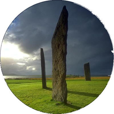
stone circles : cost-effective photogrammetry techniques for surveying, recording, documenting [pdf 25pp] #StoneCircle #photogrammetry #KiriEngine #lidar https://arrow.tudublin.ie/cgi/viewcontent.cgi?article=1230&context=level3
Recent searches
Search options

#photogrammetry
0 posts0 participants0 posts today

Created Using 715,000 Photos, the Most Detailed 3D Model of the Titanic Challenges Beliefs https://petapixel.com/2025/04/10/created-using-715000-photos-the-most-detailed-3d-model-of-the-titanic-challenges-beliefs/ #nationalgeographic #williammcmaster #photogrammetry #Technology #megascapes #Spotlight #3dmodel #titanic #natgeo #News
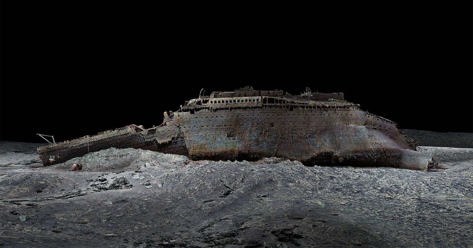
PetaPixel · Created Using 715,000 Photos, the Most Detailed 3D Model of the Titanic Challenges Beliefs715,000 photos and years later, detailed photogrammetry is changing the narrative of the Titanic shipwreck.
Digital Flower +++
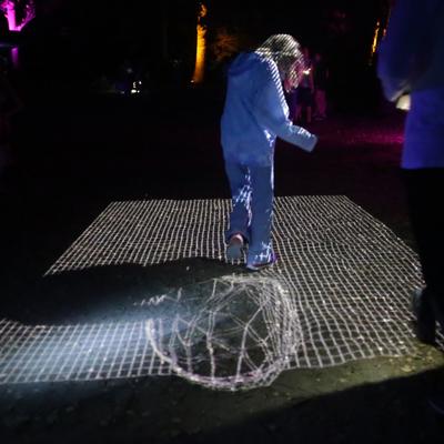
Photogrammetry + Particle of Cube= Fuse #realtime #3d #photogrammetry #vvvv #madewithvvvvgamma #fuse #particles #cube #visionnocturne


I don’t have a 3D scanner but I want to 3D scan something.
What’s the recommendation in the year two thousand and twenty five?
Photogrammetry with meshlab? Lidar scan with my phone?
I have a light box and a motorized turntable if that is useful.
Anyone east of Seattle have equipment they want to share?
@3DPrinting #3dprinting #3dscanning #photogrammetry

7- Once you have the scan, you can make replicas of your fossils by 3D printing them! Here a fossil predentary, along with the 3D scan.
Thank you to the presenters for doing such a good job, the organizers for putting this together, and the participants for making it all possible! This was an amazing way to end the Paleo 2025 symposium, and we can't wait to see you all next year!
(4 / 4)
 resting on a foam bed. In the foreground is a slightly smaller, white 3D printed version of the same fossil.")
5- High-tech photogrammetry setup! This allows us to get images of the fossil from 360 degrees. This setup, along with the app to create the scans, was significantly cheaper than my car.
6- Participants break out to scan their own fossils
(3 / 4)


2- As a Pachyrhinosaurus looks on
3- The structured light scanner along with a hadrosaur jaw, set up for scanning. This scanner cost more than my car!
4- Jackson Sweder demonstrating the scanner. Truly, living in the future is amazing.
(2 / 4)

 scattered around the jaw. The scanner itself is roughly rectangular and grey, about 30cm long and 10cm thick.")


Acoustic Levitation Gets Insects Ready For Their Close-Up - The average Hackaday reader is likely at least familiar with acoustic levitation —... - https://hackaday.com/2025/03/22/acoustic-levitation-gets-insects-ready-for-their-close-up/ #ultrasoniclevitation #digitalcamerashacks #acousticlevitation #photogrammetry #fpga
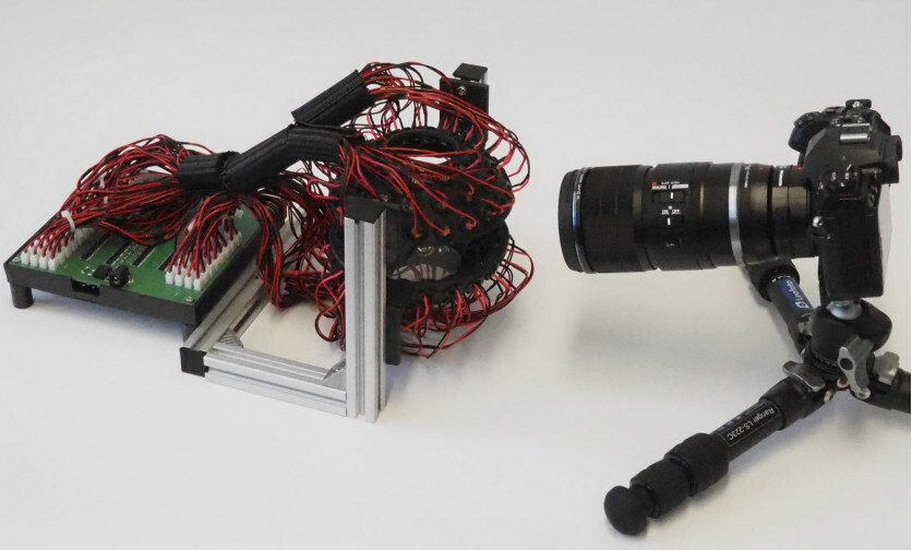
Hackaday · Acoustic Levitation Gets Insects Ready For Their Close-UpThe average Hackaday reader is likely at least familiar with acoustic levitation — a technique by which carefully arranged ultrasonic transducers can be used to suspend an object in the air i…

Photogrammetry of Lord Hill's Column, Shrewsbury.
Survey to help Shropshire Council conserve this iconic monument. The column was built in 1814-16. It is taller than Nelson's column.
You can see our 3D models of Lord Hill's column on Sketchfab.
Complete column: https://skfb.ly/p9JSW
Detail of the statue: https://skfb.ly/p9JSX
More information on our website.
GIF

With #LPSC2025 about to start, it's time to share what I've been working on during the last months.
This is a new high resolution 3D model of the Mont Mercou outcrop, that I made during my recent internship at LPG Nantes. 
GIF
Currently scouting out well maintained foss software to implement #photogrammetry into my asset pipeline for fun.
Don't want to bend over backward to get meshroom to build via the AUR. Looking into OpenMVG. I don't mind—and often prefer—a CLI based workflow, but it is not comforting to look at a github page that barely explains what the software is or how it can be used. Or worse reads like a research paper. However, a venerable european on youtube has posted several videos depicting some impressive statue reconstructions using OpenMVG and CMPMVS. I am tempted to emulate his success.

Played around with RealityScan from Epic. Had a lot of fun with it.
Scanned some fresh pastry that I got from a shop earlier.
Can already use them in a scene as is, especially if it's some background stuff, like a bunch of pastry on shelves behind a character or so.
But could also spend some time, retopo them manually and reproject color and normal maps onto an optimized mesh if you want to use it for games.
GIF
GIF
Photogrammetry Allegedly Shows LA Eaton Fire Caused by Edison Power https://petapixel.com/2025/02/07/photogrammetry-allegedly-shows-la-eaton-fire-caused-by-edison-power/ #photogrammetry #losangeles #eatonfire #wildfire #News #fire

PetaPixel · Photogrammetry Allegedly Shows LA Eaton Fire Caused by Edison PowerA combination of photogrammetry and multiple pieces of video evidence allegedly proves that the Eaton Fire was the fault of Edison power.

He intentat fer fotogrametria per primer cop amb #meshroom i ha sigut un fracàs total i absolut  Algú sap d'això per aconsellar-me? Tipus, quantes fotos haig de fer, il·luminació, anglès, configuració del programa?
Continued thread

 #EndFossilFuels
 And now you can download and 3D print a copy if you want, cause I just finished processing the first version.
https://www.printables.com/model/1165289-bicha-de-balazote-escultura-iberica-museo-arqueolo


reposting my bulk XMP updating tool for photogrammetry users, got auto-deleted and this toot will serve as a comment section for a blog entry about it
https://matthewscheffel.com/projects/bulk-xmp-updater/
this tool is useful if you have a CSV file with reliable GPS data that you want mapped to JPEG images via XMP metadata headers. I think this is common if you're using some kind of "shim" system to snapshot GPS data aligned with image collection times.
Matthew Scheffel · Bulk Xmp UpdaterI created a tool to streamline a process that I have been told is common for people working with photogrammetry data: Photogrammetry JPEG XMP Metadata Updater.
Given a CSV file1 and a directory of images, this tool will update the XMP metadata for the images to match the latitude, longitude, and altitude specified in the CSV for that file. This is useful when your camera GPS metadata is less accurate than the GPS metadata from another source.


#VendrediLecture  #FridayReading
 Digitizing Historical Aerial Images: Evaluation of the Effects of Scanning Quality on Aerial Triangulation and Dense Image Matching
by Adam Kostrzewa et al.

Slowly porting over all my blog posts from Artstation.
Today I learned how to use the CSS light dark property to make the theme respond to system settings.
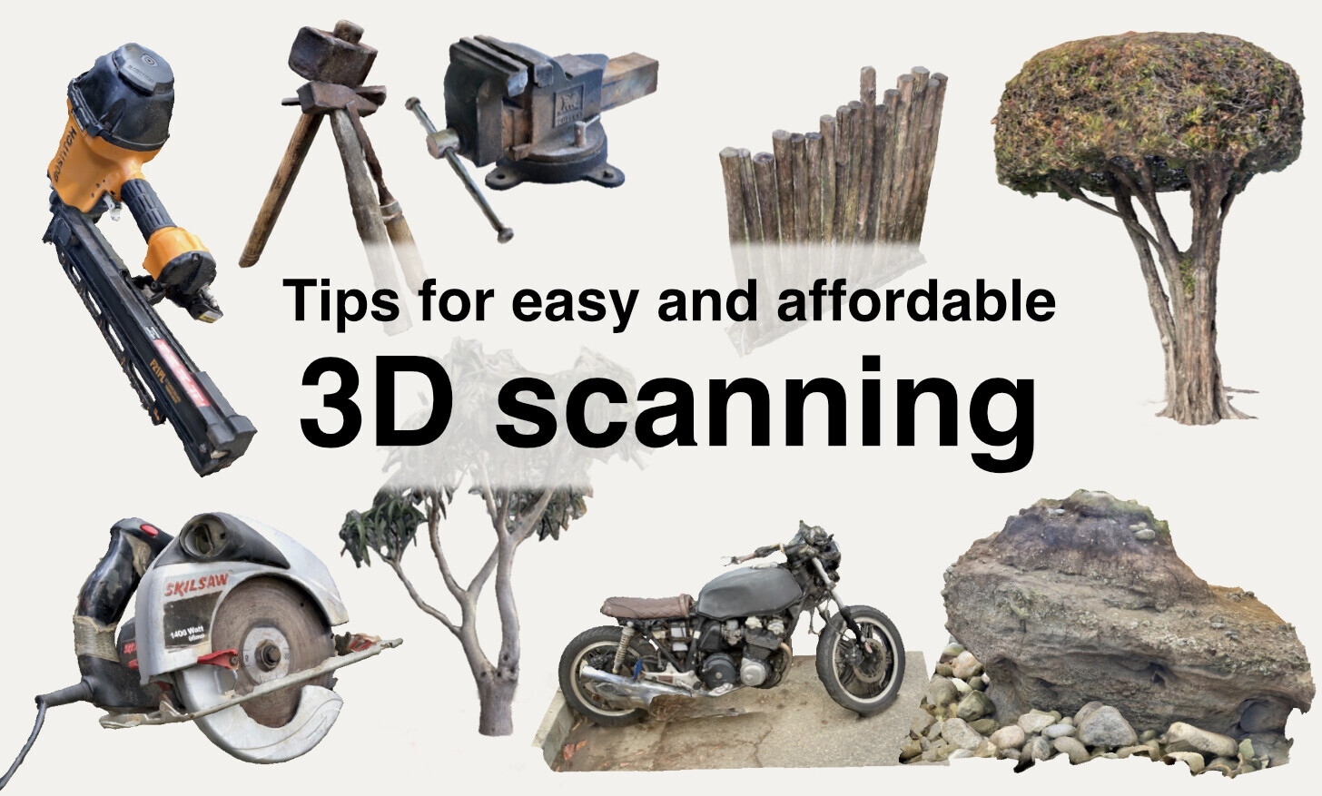
Now that the blog is in a more presentable state, here's an article with practical tips for photogrammetry 3D scanning and other methods.
https://honora.neocities.org/blog/2021-12-25-tips-for3d-scanning


Love open source? Want to give money towards something tangible? Help add a new "swipe control and simultaneous layer display" to OpenDroneMap's WebODM! The fund is all or nothing, and UAV4GEO (a maintainer/contributor, and implementing this feature) is doing a match on all donations.
https://fund.webodm.org/#/fund/7
The free and #openSource ODM tools are amazing and you should definitely check them out at https://opendronemap.org if you have any #drones #mapping #photogrammetry needs.
fund.webodm.orgOpenDroneMap Funding - Quadratik