mathstodon.xyz is one of the many independent Mastodon servers you can use to participate in the fediverse.
A Mastodon instance for maths people. We have LaTeX rendering in the web interface!

Server stats:

2.8K
active users

#OsmApp

0 posts0 participants0 posts today

So for some reason I'd like to know how long it takes to drive from Bayreuth to Cologne and I want to use alternatives to #GoogleMaps in #Germany.

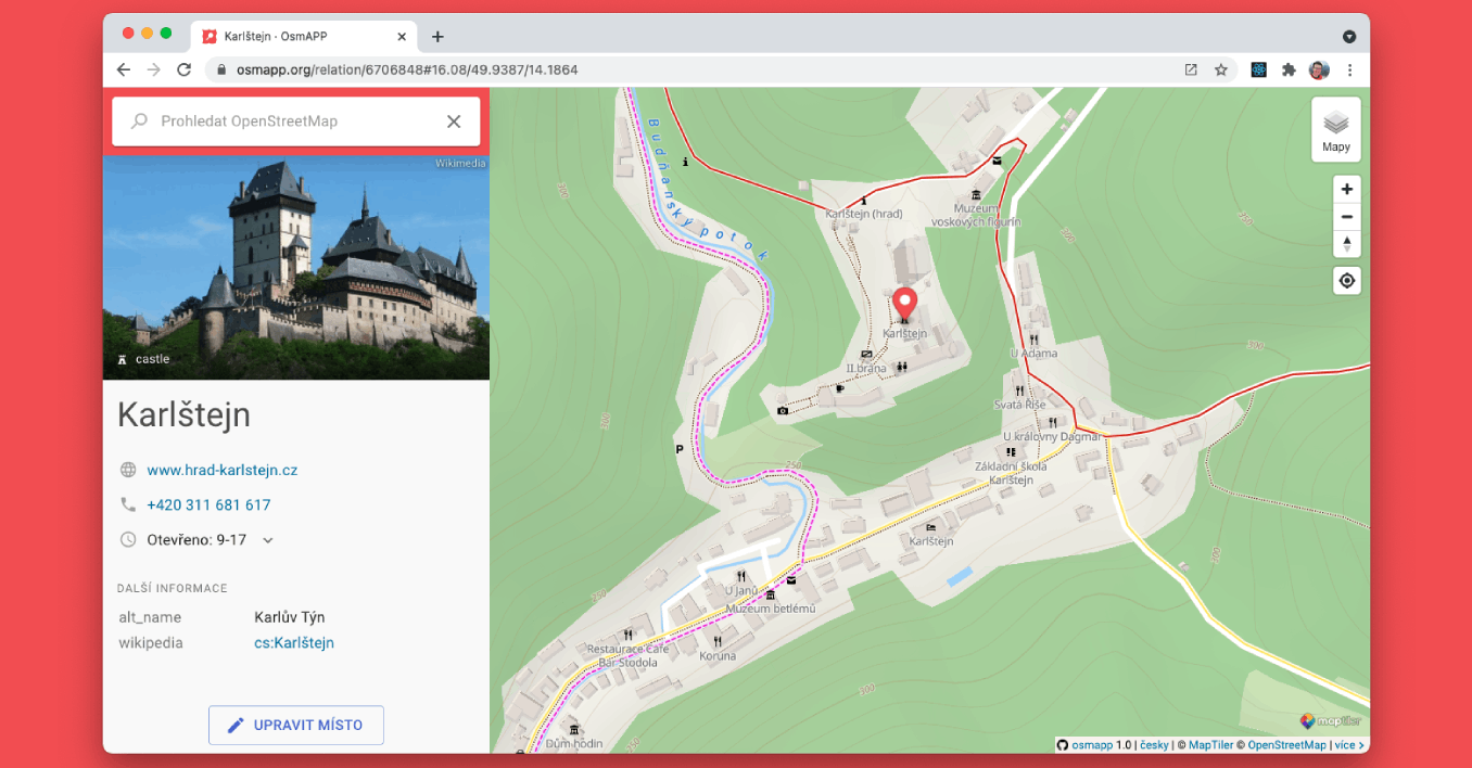
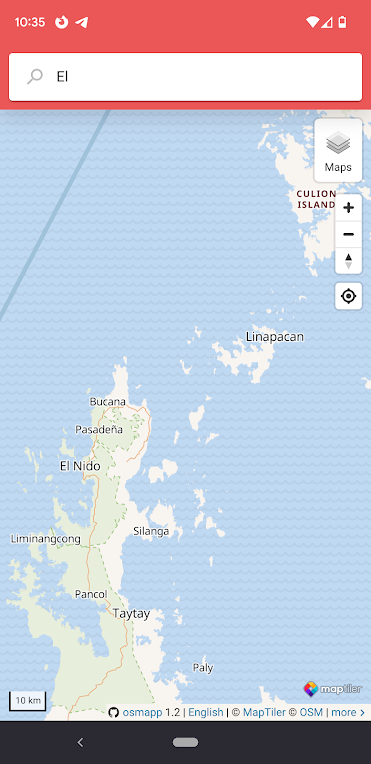
#osmapp doesn't find Bayreuth even.

#MapCarta does better, but doesn't know Köln, the German name of Cologne. Think normal users, not nerds – they won't know the English names of these German cities that have English names, at least not of smaller ones.

#OpenStreetMap.de can do it.

However, openstreetmap.de does not have any sweet scraped meta data such as opening hours of places, or photos.

It's going to be a long way to a good Google Maps replacement.

Today I had to share two GPS locations with people that most probably does not use #OpenStreetMap based maps or apps. Because of the really low support for the geo: URL scheme wiki.openstreetmap.org/wiki/Ge, this means that the best way to provide a link is with a GMaps link :(((

I found the #OSMApp osmapp.org/ can provide links for several maps providers. I find this app more and more useful.

wiki.openstreetmap.orgGeo URI scheme - OpenStreetMap Wiki
Replied in thread

@mgorny Editing OSM on mobile, with ID, is a PITA.

I have multiple apps on my phone, but the most often for these are: @everydoor , and #SCEE ¹ (the #StreetComplete fork for experienced OSM users), and occasionally , Osm Go! ², depending on the element I'm trying to edit.

For casual, or non-OSM users, I usually recommend #OsmAPP in-browser (where they can suggest changes, rather than make the edits themselves)

¹ SCEE - github.com/Helium314/SCEE
² Osm Go! - osmgo.com

OpenStreetMap surveyor app for experienced OSM contributors - Helium314/SCEE
GitHubGitHub - Helium314/SCEE: OpenStreetMap surveyor app for experienced OSM contributorsOpenStreetMap surveyor app for experienced OSM contributors - Helium314/SCEE

#OsmAPP is becoming a very user-friendly front-end for #OpenStreetMap. Kudos to their very nimble team!

For example, without having to learn #Overpass, from the searchbox, anyone can simply search for "wikipedia=* to find features tagged with wikipedia=*

Or, maybe finding nearby emergency shelters.

These days I use them a lot as a way of sharing a location to other people, rather than a link coming from OSM itself, or any other mapping platform.

#geoURI is actually supported!

@sesivany @honzajavorek já ještě mapy.cz na turistiku se značenými trasami. Google maps na hledání recenzí různých podniků. A na navigaci v autě Waze. Na korporátních aplikacích mi vyhovuje pohodlí správy oblíbených míst a tras s jejich synchronizací mezi zařízeními za cenu ztráty části svého soukromí...
Zkouším #OrganicMaps #OsmAPP a aplikaci na ploše mobilu z webu openstrretmap.org - ta je taky překvapivě funkční.

Wondering what app in the #OpenStreetMap ecosystem to recommend, as altenative to Google Maps>

Intuitive app with map navigation, no user tracking, no ads:
*#OrganicMaps

Curious about OSM? Occasional map user, don't want to install anything?
* #OSMapp
* #QwantMaps

Mobile Editors
* #vespucci (Android) - power editing on the go
* #GoMap! (iOS) - intuitive editor
* #StreetComplete - gamified approach to OSM editing.
* #EveryDoor simple POI editor.
* #OSMapp (anonymous "editing" with notes)

Continued thread

The best thing I like about #Qwant is that routing (foot, bike, car) is available to users, something you will miss from #OSMapp.

Knowing this is possible, I hope that OSMapp can do in future versions.

Both are great for casual users, but if routing is essential, go for #Qwant. but #OSMapp looks a teeny-bit more user-friendly when editing from a mobile.

Of course, nothing stops you from having both, since they're pretty light on your system.

Continued thread

Two great examples of #webapps that uses #OpenStreetMap comes to mind: #OSMapp and #Qwant

You can "install" these in your mobile device, but they are apps that run in your browser. Not a separate app. They only work online, but probably not an issue for casual users.

Both apps offer beautiful map layers. None of them require an #OpenStreetMap account.

With #OSMapp you may still "edit" a feature without an account, but your changes are recorded as notes, while #Qwant uses OSM editors.