Recent searches
Search options
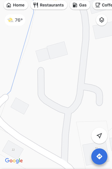
Maybe it's asking too much but I think a tool used for navigation ought to display street names. And if there are too many to fit on the screen, allow users to zoom in and then display the street names. But often no amount of zooming seems to work in Google Maps. Google do such a great job building enormous systems but I think users are just considered an inconvenience.
I used to make fun of Apple Maps but at this point its UI is far better than Google Maps.
@dpiponi I think it's been getting progressively worse? Recently had to do the "try zooming in and zooming out randomly until the street name appears (and then disappears a millisecond later)" dance way too many times.
@BartWronski It may always have been this bad :)
@dpiponi @BartWronski I’m pretty sure it’s always been this bad: I had this frustration with gmaps’s inability to show me what street I’m on for several years. Switched to apple maps way back then, while it wasn’t good yet, but at least it wasn’t bad in that way.
@antifuchs @dpiponi ugh, might give apple maps a try, then. I dismissed it as ugly and for a long time it was lagging re public transport and bikes (my main two modes of communication), but for exploring neighborhoods Google maps is borderline unusable now :(
@BartWronski @antifuchs @dpiponi
In UK, at least, OpenStreetMaps is much better in showing many things better, compared to Google Maps. E.g.in street names, pedestrian walking paths.
It lacks in public transport info, but does better job in cycling routes.


